Hiking trail : the Vallon du Clou

1 / 3
4h30min
9.7km
+475m
Description
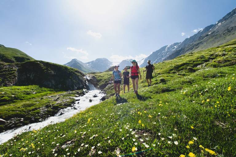
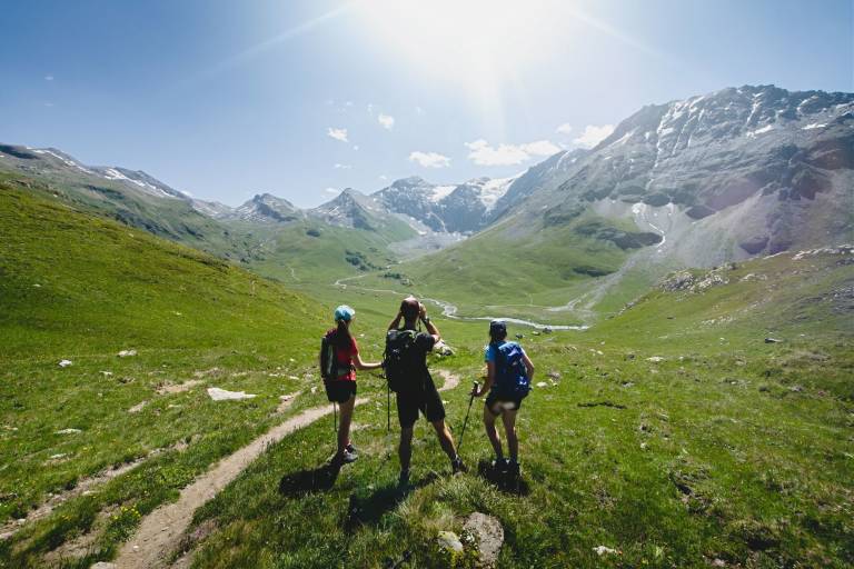
The Vallon du Clou is a protected site, which culminates at 3,567 m altitude at the Pointe des Chamois.
A sportive hike to discover the Lac Noir perched at 2618 m and the views of the Balmes glacier.
Map available at the Tourist Office.
From the P3 car park, continue on the forest road towards the hamlet of Echaillon and continue to the listed hamlet of Le Monal. Cross the hamlet of Le Monal and continue straight on. Shortly after entering the forest, take a path on the left which winds upwards. At the first crossroads after leaving the forest, turn right, join and turn left onto the pastoral road that climbs up from Chenal and follow it towards Le Clou. Make a detour to the left to admire the stele that has been erected on the village of Le Clou.
Same route for the return.
For your convenience, a free shuttle bus is available (summer season only) from Sainte-Foy Station, at the Mélèzes car park, to the Echaillon car park.
Access to the Echaillon car park, the starting point for hikes to the hamlet of Monal and the Clou valley, is forbidden to private vehicles. The aim of this measure is to preserve natural areas and their flora and fauna. As a result, a free shuttle service will be provided from the Mélèzes car park in the Sainte-Foy resort during the summer season from 01 July to 31 August.
By municipal by-law no. 2024/36 regulating access to the mountain pasture roads from Bonconseil to Planbois and from Bonconseil to Le Monal.
Pricing
Free access.
Route GPX track
73640, Sainte-Foy-Tarentaise
From 01/05 to 30/11 daily.
Subject to favorable snow and weather conditions.