Itinerary for snowshoeing: the Drains
2h40min
4.3km
Loop
+240m
-240m
Description
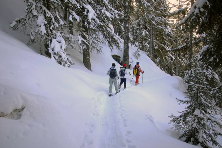
Itinerary marked out from the resort with a panoramic view of Mont Pourri, Le Thuria and the Aiguille Rouge. A good part of this route is in the forest.
Map available at the Tourist Office
Take the tarmac road for about 150m. After the flat area in front of the chalets, put on your snowshoes. Cross the ski slope, paying attention to the skiers. Continue up a gentle slope towards the hamlet of Planay above. At the end of the forest, admire the panorama of the Tarentaise valley. Enter the village and after a few houses, take the wide and steep RIGHT path away from the village. When you reach a few chalets, turn RIGHT at the junction. Admire the DRAINS of Sainte Foy. Man-made construction to limit the infiltration of water into the soil and to protect against landslides, which used to be regular. After the flat path, cross the small bridge. The slight climb takes you back to the E route, which takes you back to the path you took on the way out. Return on the same tracks to the chapel.
Route GPX track
Bonconseil Dessus, Station, 73640, Sainte-Foy-Tarentaise
From 01/11 to 30/04.
Subject to favorable snow and weather conditions.